| |
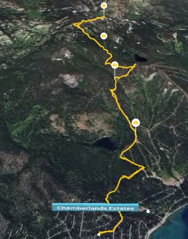
Ever since I first laid eyes on a map of the Homewood area, Ellis Peak has loomed large as a destination hike. At 8740 ft, it is the highest peak in the area. And it's close proximity makes it theoretically possible to hike to from the cabin.
|
|
|
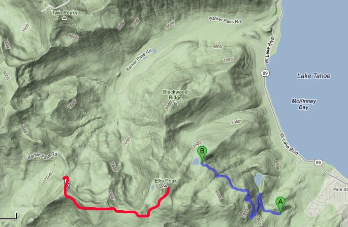
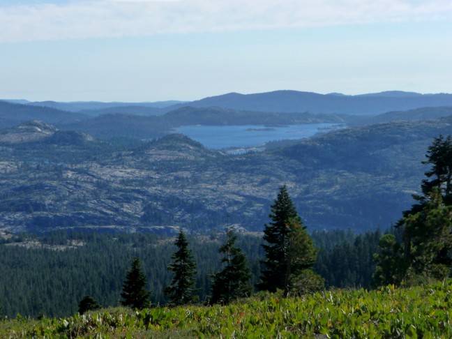
June and I first began by exploring the wooded area of Homewood Ski Resort, the big canyon just to the right of B in the above image. The blue road shown from A to B is called the Noonchester Mine Trail (NMT). We have actually found remnants of the old mine just off the trail. The cabin is in the subdivision of streets just to the right of A. The red line is another hike that we have taken from Barker Pass to Ellis peak. The challenge is to find a way is to hike from the cabin to Ellis Peak and back. |
|
|
|
One evening, we took a walk up the hill and then ventured out into the woods. In July 2011, the wooded area adjacent to Chambers Landing subdivision was flooded with water flowing everywhere. At the time we thought this was normal. However, July 2012 was not nearly as wet. |
|
|
|
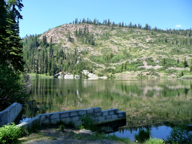
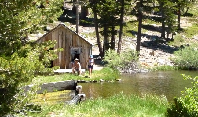
That same year (July 2011) we walked to Quail Lake from the cabin. It was actually a pretty quick and easy walk through Homewood Resort, about 45 mins up. Besides the lake, the most prominent feature is a very steep and exposed ground known as Quail face. It can be seen from the Lake Tahoe area for many miles. From this vantage, you can not see the huge mountain that is Ellis Peak beyond the top of the face. The area in the foreground is the lake spillway. There is a very small trail next to the spillway. It was so heavily wooded that we tried to go down but gave up after 20 yds or so. We lingered by the spillway long enough see three guys come up the trail. So we took it again and found that it dumps out quite a bit closer to the cabin. |
|
|
|
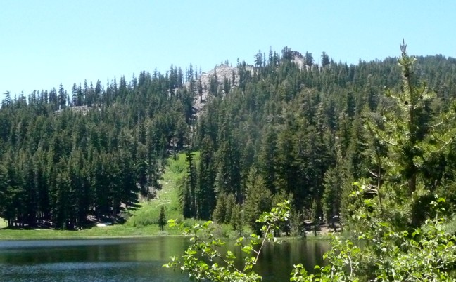
Standing on the NMT, that's Quail Lake in the background. Not shown is Quail Face, the cliff behind June and Alicia. To the right of them about 2 miles south is the McKinney-Rubicon trail. June and I discovered that area when looking for a place to snow-shoe. It is also a very nice, but relatively short, road bike ride from the cabin. June and I first found the NMT August 2011, but only got this far. From the cabin, it takes a LONG time to get to this point above Quail Lake. I will need to find a shorter route in order to make the cabin-to-Ellis and back climb feasible. In July 2016, we were on a hike to the base of Quail Lake with Keli and Stevie. In my efforts to find a shortcut, I walked on my own around the right of the lake (in the previous pic) and found myself at the base of Quail Face. Then I did something very stupid. I climbed up Quail Face to this point. Learn more. |
|
|
|
In July 2012, Bruce and I rode bikes on the blue road on map at the top of the page to Lake Louise and down the other side of Homewood. Just before Lake Louise (shown here), we came across these two hearty souls, Sandy (69), and Missy (60) who were jogging up to Lake Louise, actually 'bush-whacking" up the Glades ski run which is fairly close to Quail Lake. Wow! If it's possible for me, that is the shortcut I have been looking for! |
|
|
|
Missy told us of a friend who continued through the brush, up to this peak (Ellis?) behind Lake Louise. So Bruce convinced me that there is no time like the present. |
|
|
|
We hid the bikes in some bushes and headed up. An hour later, and VERY tired from bushwhacking straight up, we arrived at the peak. Lake Louise in the foreground. Once there, we noticed a higher mountain behind this peak. That peak, still far away, was obviously Ellis Peak. But this little excursion was still an adventure. Then, after searching more maps, I found a trail starting just to the right in the above image, around the fake peak to the real Ellis Peak. |
|
|
|
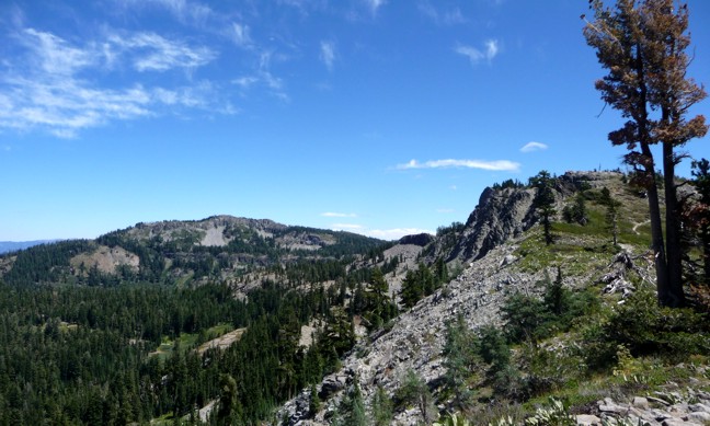
In August 2012, June and I first hiked to Ellis Peak, but first we took a long drive from the cabin to a parking lot at the top of Barker Pass. This hike was the Red line in the map at the top of this page. The trail starts out by going up a pretty steep hill through a forested area. The first half mile or so is tough, but then it breaks through the trees and you get this great view of the rest of the hill (to the right in the above pic) and Ellis Peak, 3 miles away on the left in the above pic. The walk continues up, across the ridge, down a steep hill, then up the right side of the hill in the distance, which gets pretty steep at times. Still, it's a pretty easy hike. |
|
|
|
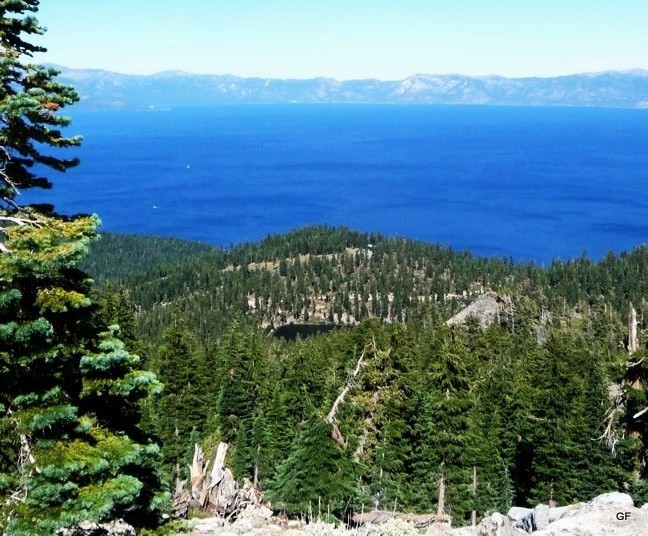
At about the same location as the previous pic, looking West. That is Hell Hole Reservoir. |
|
|
|
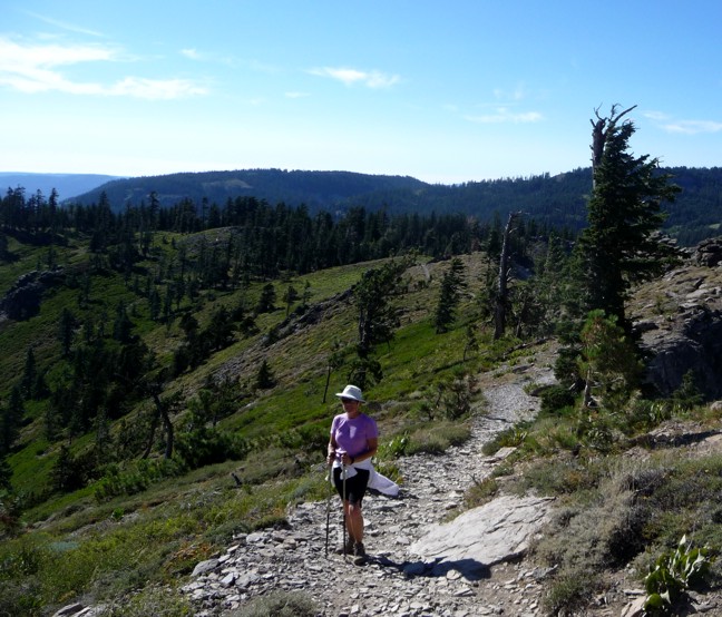
June taking in the sights along the ridge. |
|
|
|
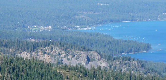
Tahoe city from Ellis Peak. Eagle rock in the lower-right corner. |
|
|
|
Same view of Lake Louise but from the REAL Ellis Peak. Just to the right of the lake is the fake Ellis peak. |
|
|
|
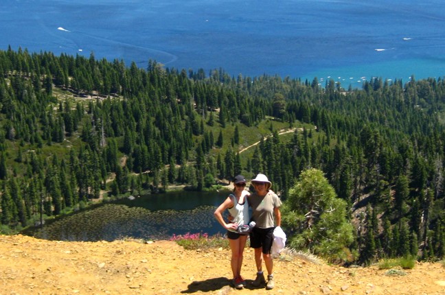
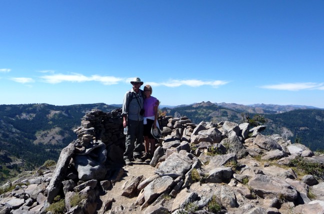
Us at the top of Ellis Peak. Twin Peaks, across Blackwood canyon, in the distance just to right of us in the pic. In Sept. 2015, Jim Kerr and I did this same walk, and then walked back to the cabin from here. We just followed what looked like a trail down towards Lake Louise and eventually ran into it. I made a mental note of what it looks like. I'm sure I can find the trailhead from the NMT, but the trail up the mountain is not as obvious. The goal of up and back to Ellis Peak from the cabin is now in sight. I calculated it once to be about 10 miles with elevation gain of 2500 ft. |
 |
|
Success!! On August 30, 2017, while Cora was napping, I walked up to Ellis Peak from the cabin by myself. I didn't leave the cabin thinking I would make it but I wanted to check out how difficult it would be to hike up the Glades ski run at Homewood. It went very easily once I did the first 100 yds or so. I Strava'd the hike and it is listed at the link below. In short, it was 8.8 miles, 2600 ft elevation gain, and it took me 3:25 hours. This image is from Relive.cc. Brandon showed me this app, which is powered from Strava. Very cool. It renders a 3D version of the event. https://www.strava.com/activities/1160600030 Since then, here are other times that I have done it:
|
This page was edited in June 2026. I have been up to Ellis a few times now, and it's getting tougher!